Rest and Be Thankful closed until further notice
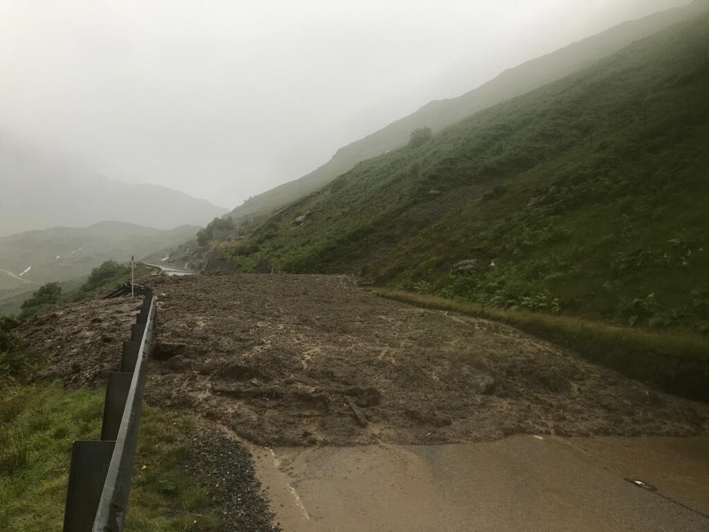
Multiple landslips have blocked the A83 at the Rest and Be Thankful 'until further notice' following the heavy rain yesterday.
The closure means a 59-mile road diversion for some drivers.
Debris from the landslips blocked the well-used route in both directions on Tuesday as well as the Old Military Road, which has previously been used as an alternative pass.
Around 65mm of rainfall was estimated to have fallen at the Rest and Be Thankful during the relentless deluge and on Wednesday 'horrendous conditions' were still hampering efforts to carry out safety checks.
Both roads remained shut overnight on Tuesday and risk assessments were due to resume at first light today (Wednesday).
Specialist geotechnical contractors carried out initial visual assessments from the roadside but initial indications were that there was still movement on the hillside delaying the start of any clear-up operations and carrying out further checks at that time.
A 59-mile diversion route has been implemented between Tarbet and Cairndow via the A83, A82, A85 and A819.
Temporary traffic lights were also in place on the A82 on Tuesday at Inveruglas after heavy rain affected a retaining wall following a day of challenging conditions.
BEAR Scotland said ferry provider Western Ferries can accommodate diverted traffic. Go to western-ferries.co.uk for timetable information.
Motorists are being advised to follow Traffic Scotland to get the latest journey information.
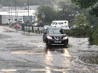
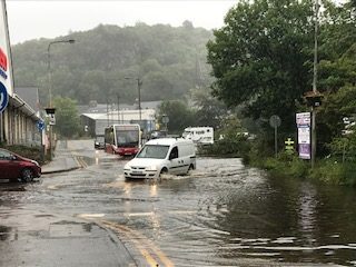
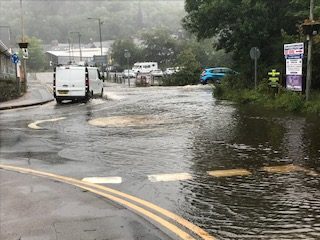
Heavy rain on Tuesday also hit other areas of Argyll hard, with localised flooding at Lochavullin car park and roundabout; and along the A816 at Kilninver; Melfort, Kimelford, Ford road end and Kilmartin. The A85 at Loch Awe, was also flooded in the Awe Barrage area, which eyewitnesses described as 'horrendous'. Flood warnings were also issued for Kintyre and Islay. And Oude Dam by the side of the A816 was also in 'spectacular' spate.
Inspector Julie McLeish said this morning: 'Flooding is subsiding and the local roads that were closed have all been reopened. Roads were impassable on A816 between Lochgilphead and Cairnbaan, and around Kilmartin and Ford road end. On the A83 the road was also impassable between Minard and Furnace.'
Drivers heading to Seil also had to negotiate deep pools of water, with the force of the rain shifting gravel from the drive at An Cala open garden in Ellenabeich onto the road into the heritage village.
Officially, the Met Office said the wettest recorded place in the UK on Tuesday was Tyndrum, with 71mm of rain recorded, equivalent to 2.7in.
A poll has been started on the A83 Facebook group voting for alternative solutions including building a canopy over road; a tunnel through hill; a bridge up the middle of the glen; replanting trees; a new road on the far side of glen.
This video shows the flooding about 4.30pm on the road between Lochgilphead and Cairnbaan. It was taken by Pamela Self.
Flooding at Lochavuillen estate in Oban. Photograph: Kevin McGlynn
Flooding at Lochavuillen estate in Oban. Photograph: Kevin McGlynn
Flooding at Lochavuillen estate in Oban. Photograph: Kevin McGlynn

Oude Dam in spate. Photograph: Andrew Spence


Sign up to our daily Newsletter
Permission Statement

Yes! I would like to be sent emails from West Coast Today
I understand that my personal information will not be shared with any third parties, and will only be used to provide me with useful targeted articles as indicated.
I'm also aware that I can un-subscribe at any point either from each email notification or on My Account screen.
Accept
Cancel
You may also like


Sign up to our daily Newsletters
Permission Statement
Yes! I would like to be sent emails from West Coast Today
I understand that my personal information will not be shared with any third parties, and will only be used to provide me with useful targeted articles as indicated.
I'm also aware that I can un-subscribe at any point either from each email notification or on My Account screen.
Accept
Cancel
© 2025 Wyvex Media Limited.